
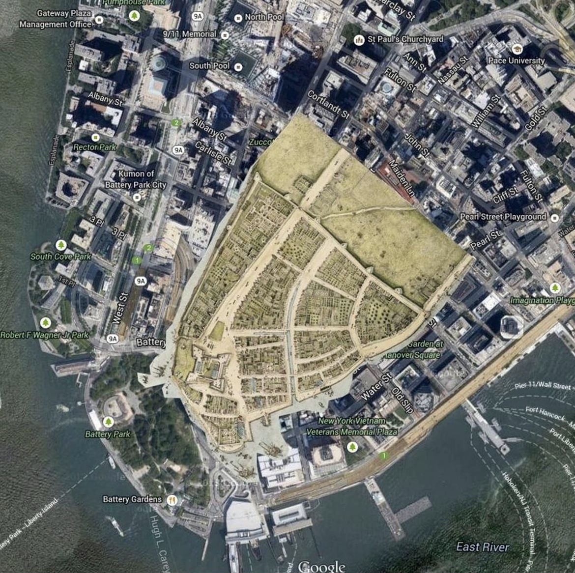
1660 map of New Amsterdam (renamed New York City by the British) superimposed over a current Google satellite image of the southern tip of Manhattan. We can see from the image that lower Manhattan was originally much narrower than it is today.
If we focus on just the 1660 map…
时政
(
twitter.com
)
1660 map of New Amsterdam (renamed New York City by the British) superimposed over a current Google satellite image of the southern tip of Manhattan. We can see from the image that lower Manhattan was originally much narrower than it is today.
If we focus on just the 1660 map (swipe left), you'll notice the 12-foot wall running along the northern border (located on the right side of the image), which was constructed to keep the indigenous people out. Prior to the wall, the Dutch governor, Williams Kieft, had broken a treaty and had sent his men to massacre an entire tribe. The few that managed to escape alerted the other tribes, which increased hostilities towards the Dutch settlers.
Today there is no wall, but a street that is aptly named Wall Street. Broadway (the widest street) begins on the left at the star-shaped fortification, Fort Amsterdam, and goes beyond the wall. Pearl Street used to be on the island's eastern waterfront and was given its name because its shoreline was rife with oysters. Water Street is an extension of Pearl Street and used to be right by the water.
A century later, near the time of the American Revolution, the city began selling water lots, which were then filled up with landfill to create more usable land. Over the centuries, lower Manhattan morphed from a skinny marsh outcropping into a dense urban city.
点击图片查看原图

点击图片查看原图

